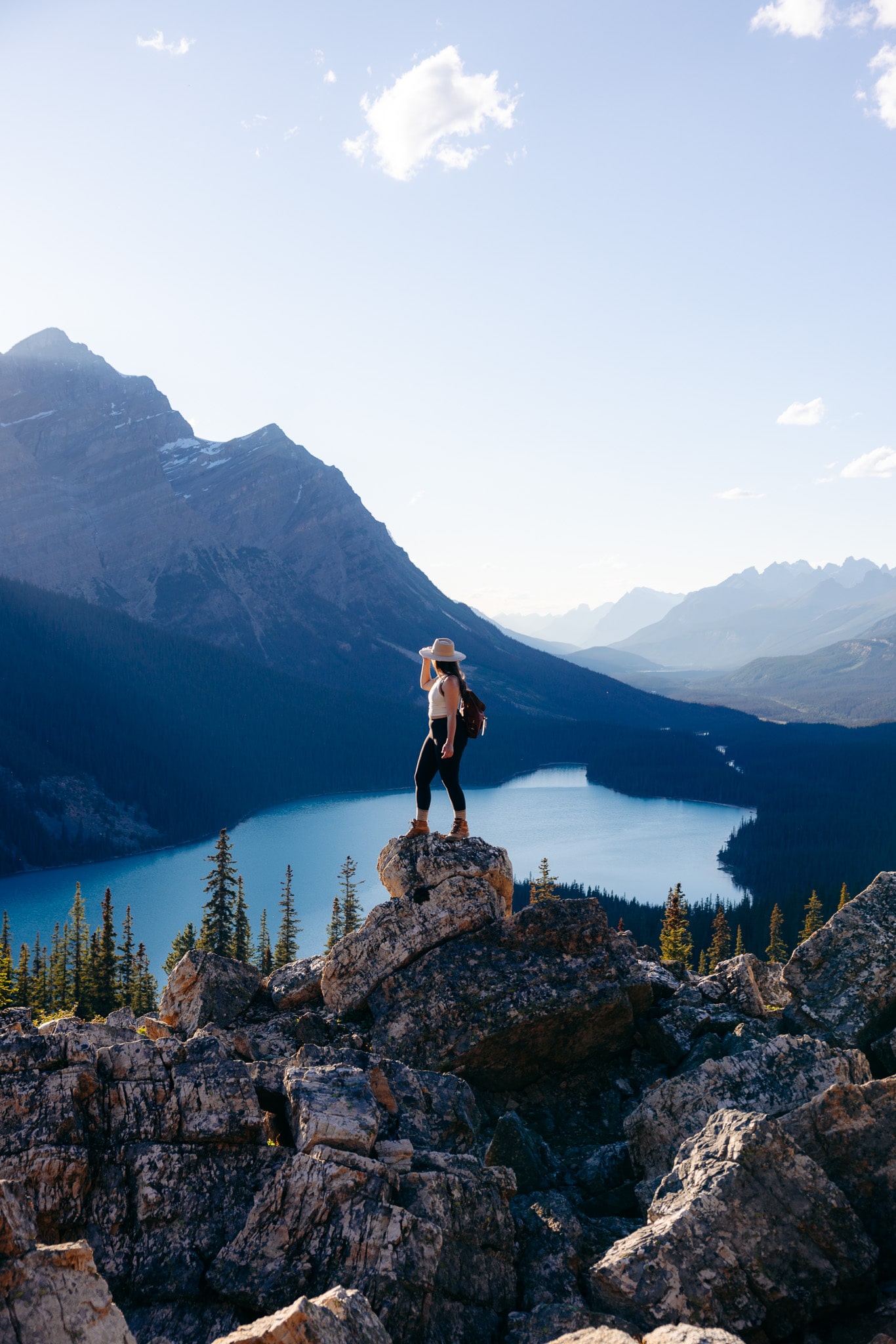
The 11 Best Day Hikes in Banff for Your Bucket List
Post summary: 11 amazing hikes in Banff National Park you can’t miss
It’s hard not to lose yourself in a place like Banff National Park, but honestly, you won’t mind once you see its dramatic peaks, gatorade blue lakes, and thick, blanketed forests.
That’s another reason why hiking in Banff needs to be on your bucket list if it isn’t already. But there are hundreds of hiking trails to choose from, so which hikes should you choose?
I’ve road tripped Banff several times and rounded up my top picks for best day hikes in Banff, Canmore and the Icefields Parkway – plus tips to make your hiking adventure extra special.
Guides to help you plan your trip to Banff National Park
How to Travel Banff on a Budget
How to Use Google Maps to Plan Your Next Road Trip (Step-By-Step Tutorial With Examples)
What to Pack for a Day Hike: Essential Gear and Complete Packing List
15 Useful Apps to Download Before Your Next Road Trip (for Free!)
Where is Banff National Park?
Banff National Park is within the Rocky Mountains, on the border between Alberta and British Columbia. The main town of Banff is 80 miles northwest of Calgary and 179 miles south of Jasper in Jasper National Park.
Hiking in Banff: Planning Tips
- Remember to Leave No Trace. Human impact causes severe damage to natural spaces. It’s important to practice thoughtful, responsible, and sustainable outdoor activities. Always pack out your trash (yes, even apple cores and orange peels!), respect all wildlife, and follow local guidelines so we can protect these beautiful places for generations to come.
. - Do your research and be prepared. Banff is 4,500 feet above sea level, so most hikes begin at a high altitude and increase from there, with trails featuring plenty of rocky sections and weather that changes FAST.
. - Bring your bear spray. Banff National Park is in the middle of grizzly bear country, so bear spray is essential to hike safely. You can rent bear spray at any of the outdoor stores around Banff.
. - Get a Parks Canada Pass. Most of the top hikes in Banff are located within Banff National Park, which requires you to purchase a Parks Canada Pass. You can order one before you go, or pick one up at the park once you get there.
. - Get an early start. The hikes on this list are the best hikes in Banff for a reason! They’re beautiful, but very popular and get crowded fast. The earlier you start your hike, the easier it is to find parking and avoid crowds on the trail.
The Best Time to Visit Banff
- Summer: Summer is the best time to visit Banff, during July and August. It’s great for hiking because of longer days and moderate daytime temperatures (72°F).
- Fall: Starting in October, fall in Banff means cooler daytime temperatures (50°F) while sunlight hours remain almost the same as summer. Go the last week in September – first week in October to see the larches change!
- Winter: As December comes around, so does winter, and daytime temperatures drop (24°F), with January typically being the coldest month (5°F).
. - Spring: When spring starts, the local climate warms up, but prepare for persistent cold weather and low daytime temperatures (36°F).
11 Amazing Day Hikes in Banff
Upper Grassi Lakes Trail
Trailhead Location: Canmore
Distance: 2.1 miles (Out and Back)
Trail Rating: Moderate
Elevation Gain: 518 feet
Swimming allowed: No
A Kananaskis Conservation Pass is required for this hike.
The Upper Grassi Lakes Trail is one of the most beautiful easy hikes near Banff National Park and has some of the most spectacular scenery in the area.
The trail leads to a pair of crystal clear turquoise lakes, nestled at the base of dramatic cliffs and surrounded by thick forest. When the sun shines, the water turns the most incredible jewel-toned color – almost like an emerald green.
The Grassi Lakes hike is short and easy, which makes it the perfect warm up hike when you first arrive in Canmore, or a good option for a more laid back hike near Banff.
There are two routes you can take to reach the final viewpoint or make them both into a loop.
The first route is easy with some gentle inclines, but not a whole lot to see. The second route is more challenging, but a lot more scenic, and goes past the Lawrence Grassi Waterfall and overlooks the valley below.
I recommend hiking the loop counterclockwise (steep part first). The views are 10/10 the whole way up.

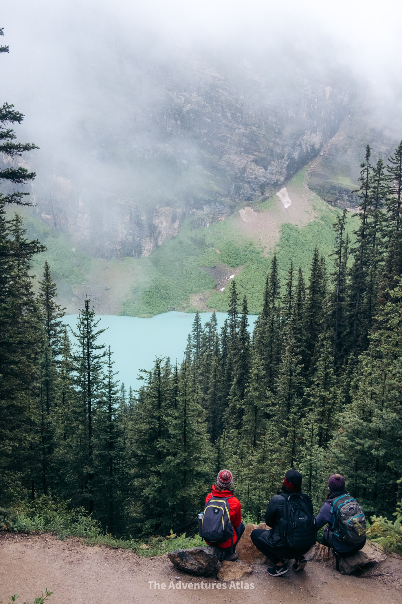
Little Beehive
Trailhead Location: Lake Louise
Distance: 6.1 miles (Out and Back)
Trail Rating: Difficult
Elevation Gain: 1,700 feet
No trip to Banff is complete without hiking the Little Beehive trail. Little Beehive is one of the best hikes in Banff and leads to jaw dropping views of Lake Louise.
The trail starts climbing almost right away, and stays that way for the entire way up.The hike might feel like a slog at times, but there are several scenic stops where you can take a break, like Mirror Lake and Lake Agnes.
As the trail breaks the treeline you’re rewarded with jaw dropping views of the mountain peaks overhead and the lake below, with various lookout points along the way.
Tip: This is one of the most popular hikes in Banff National Park, so you should definitely get an early start. This also gives you time to stop at the Lake Agnes Tea House on the way up without the lunch crowds!
 Summit of Little Beehive hike in Banff
Big Beehive
Trailhead Location: Lake Louise
Distance: 6.7 miles (Out and Back)
Trail Rating: Difficult
Elevation Gain: 2,355 feet
There’s a reason the Big Beehive trail is one of the best hikes in Banff National Park. It’s like Little Beehive, without the crowds.
If you have the extra energy for this slightly longer, slightly more difficult hike, then you’ll get similar views to Little Beehive with a fraction of the people. In fact, you might even get parts of it all to yourself, even midday.
The trail follows the same path as Little Beehive until you reach Lake Agnes. From there, it follows a different trail with a bunch of switchbacks to the summit.
There are various vantage points at the top with panoramic views of Lake Louise and the surrounding mountains.
Heading back, you can choose to follow the Plain of Six Glaciers trail if you want to extend your hike.
 Summit of Big Beehive, Banff National Park
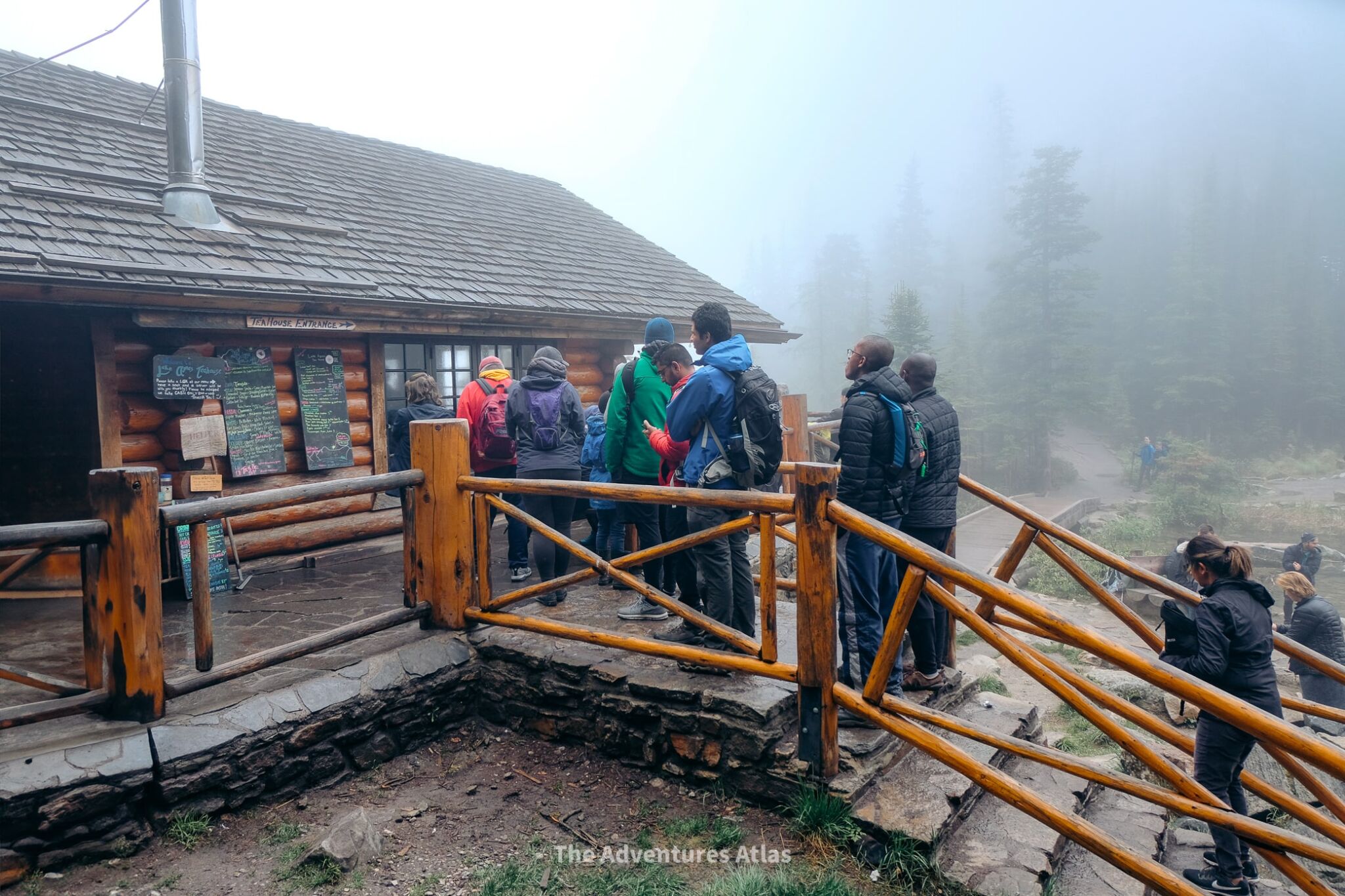
Lake Agnes Tea House
Trailhead Location: Lake Louise
Distance: 4.2 miles (Out and Back)
Trail Rating: Moderate
Elevation Gain: 1,260 feet
The tea house is open from early June to the end of October and only accepts cash. The line gets really long around 11AM, so if you get here around lunchtime, prepare to wait in line for awhile.
Not including the Lake Louise lakeshore walk, the Lake Agnes Tea House trail is one of the easiest hikes in Banff.
This hike is special because the destination isn’t a summit – it’s actually a tea house! The historic tea house dates back to 1905 and is the best place in Banff to get lunch with a view…after a bit of work, of course.
The path to get there climbs through a thick coniferous forest above Lake Louise, eventually reaching the popular hanging valley of Lake Agnes.
Head inside for hot tea, handmade pastries, and finger sandwiches while you enjoy the views.
To extend your hike from here, continue to the summit of Little Beehive or Big Beehive for epic views of Lake Louise.

Plain of Six Glaciers
Trailhead Location: Lake Louise
Distance: 9.1 miles (Out and back)
Trail Rating: Moderate
Elevation Gain: 1,929 feet
The Plain of Six Glaciers trail is another classic day hike in Banff that you can’t miss with higher elevation views of Mount Victoria, the Victoria Glacier, and Mount Lefroy.
You’ll love this hike if you want something a little bit longer but not overly difficult. It’s also less crowded, which makes it a great alternative to some of the more popular hikes on this list.
The trail starts at the end of the Lake Louise Lakeshore Trail and then weaves through the forest and over some rock ledges until you reach the rustic Plain of Six Glaciers Teahouse (if it’s open, you can stop in for a quick snack before continuing your hike – cash only).
From there, the trail gets steep and rocky as you approach the Plain of Six Glaciers with views of the glaciers and Lake Louise waaaay far off in the distance.
What to know for this hike:
- Pack layers to be prepared for changes in weather and temperature as you climb in elevation.
- While the start of the trail is easy, it does become more challenging as you gain elevation. However, it is not technical or overly strenuous, and there are benches along the way where you can rest.
- Combine this hike with Lake Agnes Teahouse or Big Beehive for a full day hike in Banff National Park.

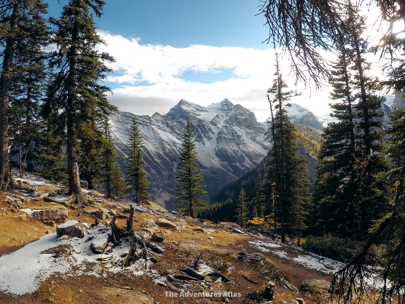
Valley of the Ten Peaks
Trailhead Location: Moraine Lake
Distance: 6.8 miles (Out and Back)
Trail Rating: Difficult
Elevation Gain: 2,457 feet
These stats are for the combined Larch Valley to Sentinel Pass hike
This is the hike that’s all over Instagram with the golden larch trees every fall. If you want to see it in real life, then you need to hike the Valley of the 10 Peaks trail through Larch Valley/Sentinel Pass.
This is one of the most beautiful hikes in Banff all year round, but it’s extra stunning in late September and early October when the larches turn gold.
This hike follows a series of switchbacks from the trailhead just past Moraine Lake Lodge. It first leads to a larch forest above Moraine Lake before continuing up a dramatic mountain pass.
Here, you’ll see the extensive larch forest and panoramic views of the mountains that make up the Valley of the Ten Peaks.
Most people stop at Larch Valley once they reach Minnestimma Lakes at the base of Sentinel Pass.
But if you want to extend your hike, you can continue through Larch Valley to hike the strenuous Sentinel Pass trail that snakes its way up a mountain pass between Pinnacle Mountain and Mount Temple.
Tip: If you continue through Sentinel Pass, make sure to pack accordingly because the weather changes fast at elevation.
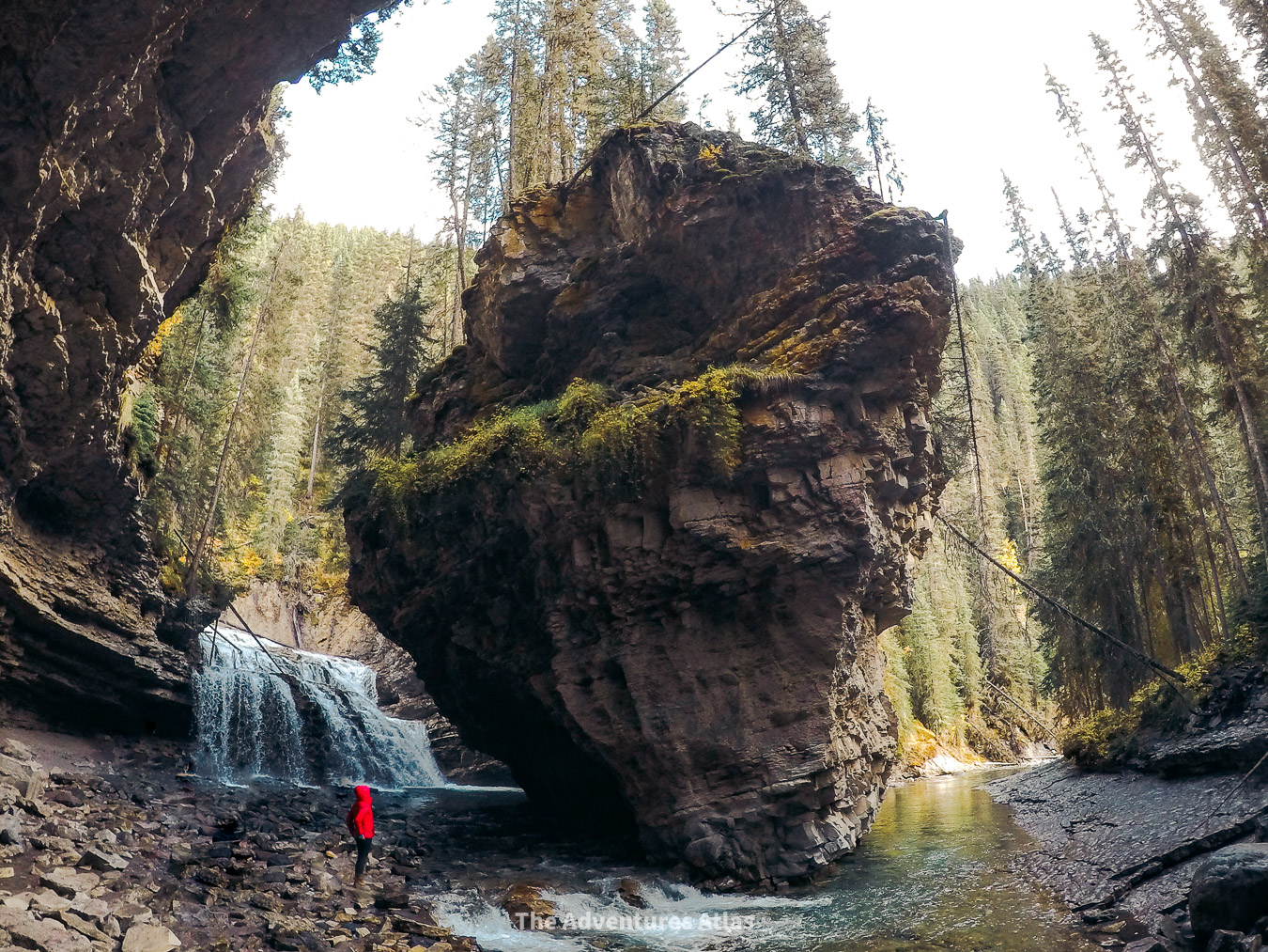
Johnston Canyon
Trailhead Location: Bow Valley Parkway, Banff National Park
Distance: 7.4 miles (Out and Back)
Trail Rating: Moderate
Elevation Gain: 1,738 feet
The Johnston Canyon trail is hands-down one of the most iconic spots on the Bow Valley Parkway and a must-do if you’re looking for an easy, yet jaw-droppingly beautiful hike, in Banff.
Picture emerald-green pools, multiple waterfalls, and the peaceful sound of a creek weaving through the canyon.
The hike is more like a walk, mostly along catwalks that take you along the canyon walls. It’s perfect for anyone looking to explore one of Banff’s most beautiful spots without a ton of effort.
The hike to the Lower Falls is just 1.2 km, and if you’re up for more, another 1.3 km takes you to the Upper Falls, where the views get even better.
Overall, it’s an easy, scenic hike with a huge payoff that’s open all year round.
Note: Parking is limited, so get here before 8AM to avoid the crowds in peak season or take the public shuttle.


Consolation Lakes
Trailhead Location: Moraine Lake
Distance: 3.9 miles (Out and Back)
Trail Rating: Easy – Moderate
Elevation Gain: 882 feet
Moraine Lake is the starting point for some of the best hikes in Banff and one of my favorites is the Consolation Lakes trail, which starts near the stairs to the Rockpile on the shore of Moraine Lake.
You can’t miss the sign for the trailhead. It’s next to a giant sign recommending that you hike in groups of 4 or more due to grizzly activity. You don’t necessarily need to hike in a group of 4, but make sure you have bear spray just in case.
Overall this is a fairly easy Moraine Lake hike that many people can do. It takes most people about 2 hours to complete.
Along the way, you’re treated to stunning views of the Ten Peaks and cross Babel Creek before you arrive at the turquoise waters of Lower Consolation Lake. If you have extra energy, make the push to Upper Consolation Lake (you might even have it all to yourself).
At roughly 2 miles each way, this trail is a great way to get off the beaten path and escape the crowds at Moraine Lake.
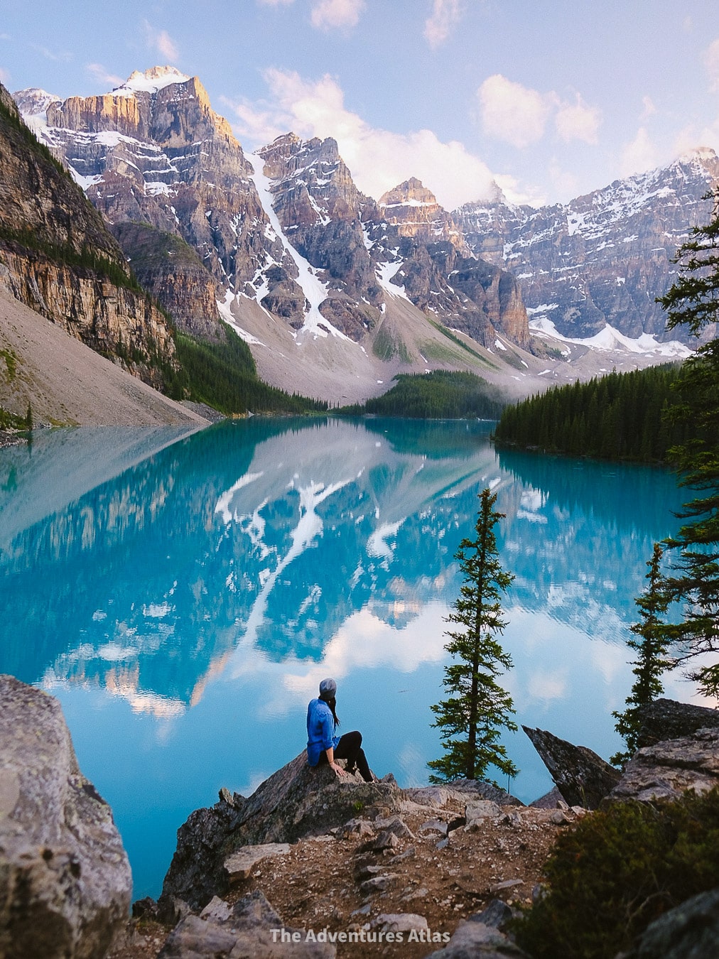 Moraine Lake, Banff
Wilcox Pass
Location: Icefields Parkway
Distance: 5.8 miles (Out and Back)
Trail Rating: Moderate
Elevation Gain: 1,700 feet
Wilcox Pass is slightly outside of Banff, but I’m including it here anyway because it’s one of the best hikes along the Icefields Parkway between Banff and Jasper National Park.
It toes the line between moderate and difficult depending on your fitness level, but is hands down one of the most rewarding hikes in this area.
It’s a challenging alternative to the Toe of the Glacier hike and gives you epic views of the Athabasca Glacier, which is one of six major glaciers of the Columbia Icefield.
The hike is broken into three sections: you’ll start by ascending through the forest to the iconic Red Chairs, then continue your climb up to the alpine meadows at Wilcox Pass before making a final push to the glacier viewpoint.
It’s common to see wildlife, such as bighorn sheep, pika, and marmots, wandering across the meadows.
Make sure to wear proper hiking gear for this hike, including microspikes. We did this hike in July and encountered quite a bit of snow just before the push to the view.
 View of the Athabasca Glacier from the Wilcox Pass summit
Toe of the Glacier
Trailhead Location: Icefields Parkway
Distance: 800 feet (Out and Back)
Trail Rating: Easy
Elevation Gain: 196 feet
The Athabasca Glacier is unique because it’s the most accessible glacier in North America and the Toe of the Glacier hike takes you right up to the base of it.
This is the perfect hike to stop and stretch your legs as you drive the Icefields Parkway, but make sure you have sturdy footwear.
While the hike is easy, the area is very rocky, and ice quickly turns to sludge, so watch your step!
The trail is well marked and there are signs along the way where you can see how much the glacier has receded over the years.
Note: You need a guide if you actually want to walk on the glacier. The best way to explore the Icefield and see the glacier up close is to book a tour at the Columbia Icefield Discovery Centre between May and October.
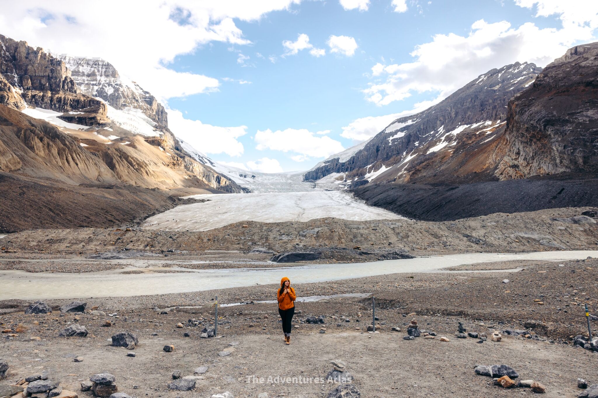 End of the Toe of the Glacier trail
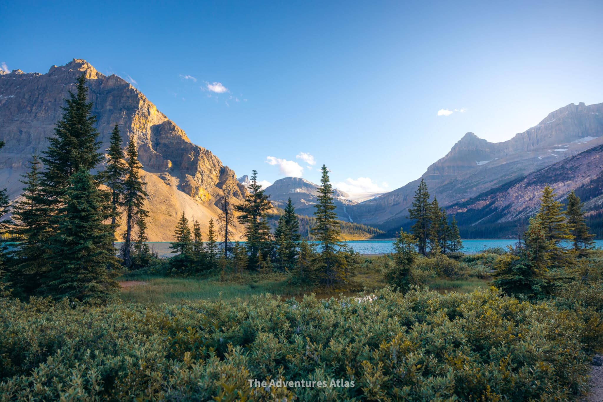
Bow Glacier Falls
Location: Icefields Parkway,Banff National Park
Distance: 5.5 miles (Out and Back)
Trail Rating: Moderate
Elevation Gain: 787 feet
Bow Glacier Falls is easily one of the most dramatic day hikes in Banff because it leads you straight to the birthplace of the Bow River!
This Banff hike starts off easy by following a peaceful shoreline trail before you ascend to viewpoints that’ll take your breath away.
Make sure to have your camera ready because the views along the way are jaw dropping.
You’ll see the river’s stunning blue waters, a series of beautiful waterfalls, and outstanding mountain views all around you.
Bow Glacier Falls is also a top pick for winter hiking, making it a fantastic trail all year round.
Did you find this Best Day Hikes in Banff helpful? Let me know in the comments!
Posts you should read next:
Banff to Jasper Itinerary: The Best Banff Itinerary: A 1 Week Road Trip from Banff to Jasper National Park
Saving money in Banff: Traveling Banff on a Budget: Effective Ways to Save Money on Lodging, Food, and Transportation
Yoho National Park, British Columbia: Yoho National Park: A 1-Day Road Trip Itinerary
British Columbia Road Trip: The Perfect British Columbia 5-Day Road Trip Itinerary
Related Posts


WANT TO SAVE MONEY TRAVELING?
Check out my list of reliable budget-friendly travel resources that are guaranteed to save you the most money, without compromising your experience.
